2022 New Year’s DayTararua’s –


SK Valleys: a long way in 23 hours and 42mins6 months ago, I had no idea that such a thing existed, but that all changed one day last year on a Tararua’s adventure with Chris when I asked the innocent question “What’s an SK?”SK stands for Schormann to Kaitoke, and to complete one you essentially travel on foot the majority of the Tararua ranges, North to South. Schormann is now known as Putara road-end, so I guess it should really be called a P-K. There are 3 different ways to complete an S-K and we opted for the “easier” of the 3 being SK valleys and to throw a bit more of a challenge in we decided to try and do it in less than 24 hours! As a rookie to the Tararua’s I really had no idea how bloody tough this actually is but I knew that Darryl was keen for a crack and that Emma was mad enough to join us. So the 3 adventurers planned to stay at Putara base camp on the 28th and get up super early and run on the 29th. But no one can control the weather, and a serve weather warning for the afternoon of the 28th with lots of rain meant that the Tararua’s would have to wait. Family life, a busy schedule of work and other commitments meant that we really had no back up dates until late March. But then the amazing Michelle (Darryl’s wife) volunteered to get up at 2am on New Years Day and drive us over to Putara.

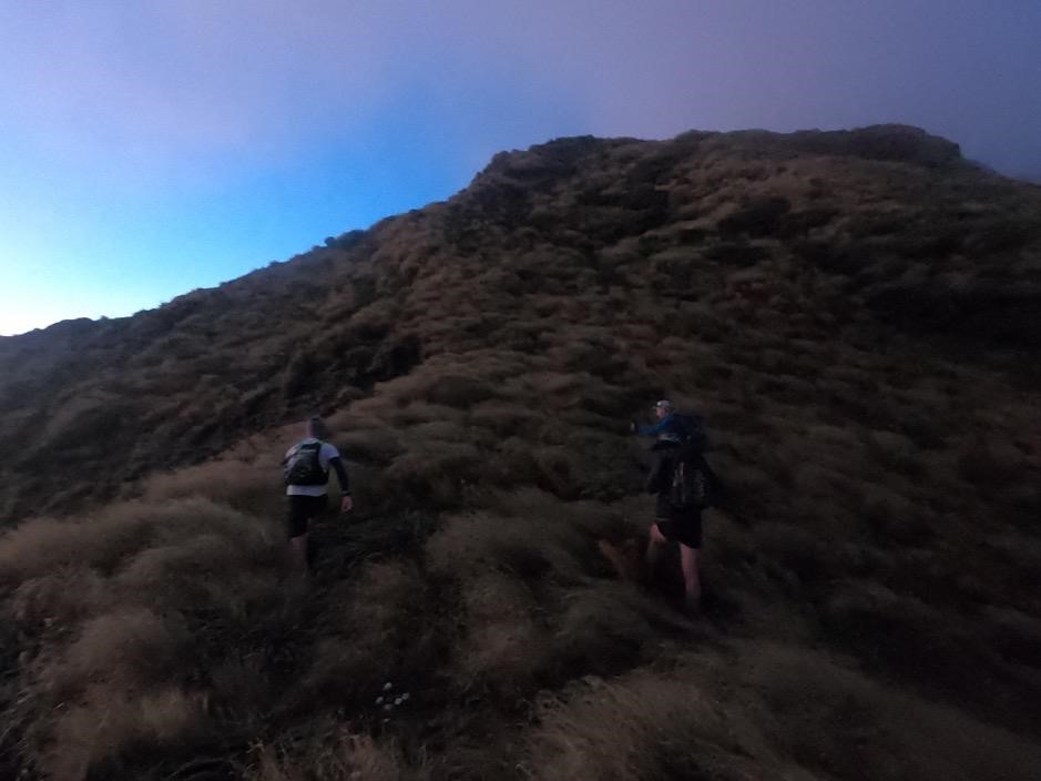
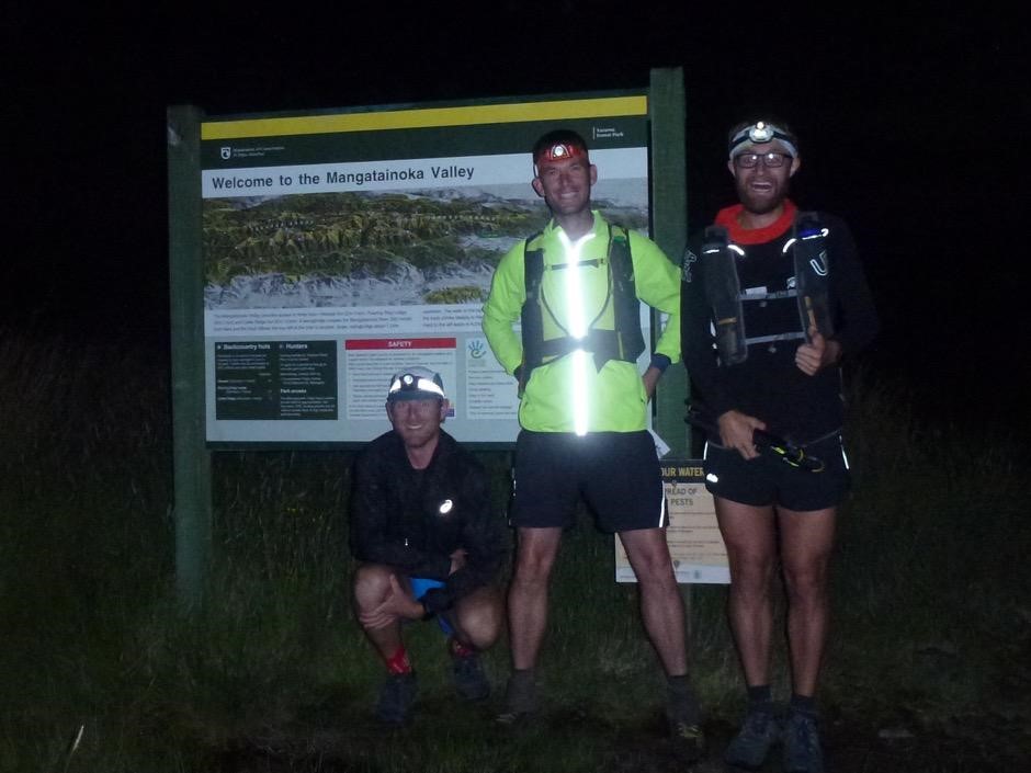
It looks like we are doing it! Michelle you are a star!!!New Year Day morning, 2.30am: I pick up Emma, the roads are busy, it’s full of people coming home from NYE celebrations. My younger self would think I am mental doing what I am about to do, what are you talking about, your older self thinks you are mental ![]() 3.15am: we drop my car at the Kaitoke road end and all jump into Darryl’s. See you again tomorrow (hopefully!)5.10am: We are ready to roll. Putara road end, the dawn is breaking. Some photos for prosperity, head torches on the ready, nervous energy. The clock starts, we are off! Putara to Roaring Stag hut: we start the journey looking at the forest through the tunnel of light from our head torches. It takes a few moments to get used to the shadows they create whilst running over the tree roots, but we soon settle into a rhythm “slow and steady, relaxed, calm”. The dawn is definitely breaking now and with it the forest is coming to life. The birds are singing and the sun is starting to glisten through the trees as we approach our first climb for the day, 770m and on towards Roaring Stag. The rain coat I put on to stay warm at the start was already packed away, it’s going to be a hot day, you can already tell. Roaring Stag Hut to Cleft Creek: now this is where it gets interesting! Off trail and into the Ruamahanga riverbed. This was the reason we pulled the pin earlier in the week. Last time I had seen this river it was in the winter time and it was raging, I could not imagine travelling down it. But today it looked good, inviting (almost). I turned to Darryl and said “which way?” his response. “Just straight down”. So that’s what we did, started off trying to pick a route down the river which was as straight as we could be and as safe as possible. This meant multiple river crossings. The river was cold, may be even refreshing, running fast and generally deep. I am glad we had made the call to come down here at 200mm, I think any higher would have just taken the fun out of it. I noticed when crossing that the rocks were very slimy and slippery, particularly the bigger ones. So trying to avoid them where I could meant for an easy route across. Until that was on the fateful crossing when the river was high, running fast and the rocks were slippery.
3.15am: we drop my car at the Kaitoke road end and all jump into Darryl’s. See you again tomorrow (hopefully!)5.10am: We are ready to roll. Putara road end, the dawn is breaking. Some photos for prosperity, head torches on the ready, nervous energy. The clock starts, we are off! Putara to Roaring Stag hut: we start the journey looking at the forest through the tunnel of light from our head torches. It takes a few moments to get used to the shadows they create whilst running over the tree roots, but we soon settle into a rhythm “slow and steady, relaxed, calm”. The dawn is definitely breaking now and with it the forest is coming to life. The birds are singing and the sun is starting to glisten through the trees as we approach our first climb for the day, 770m and on towards Roaring Stag. The rain coat I put on to stay warm at the start was already packed away, it’s going to be a hot day, you can already tell. Roaring Stag Hut to Cleft Creek: now this is where it gets interesting! Off trail and into the Ruamahanga riverbed. This was the reason we pulled the pin earlier in the week. Last time I had seen this river it was in the winter time and it was raging, I could not imagine travelling down it. But today it looked good, inviting (almost). I turned to Darryl and said “which way?” his response. “Just straight down”. So that’s what we did, started off trying to pick a route down the river which was as straight as we could be and as safe as possible. This meant multiple river crossings. The river was cold, may be even refreshing, running fast and generally deep. I am glad we had made the call to come down here at 200mm, I think any higher would have just taken the fun out of it. I noticed when crossing that the rocks were very slimy and slippery, particularly the bigger ones. So trying to avoid them where I could meant for an easy route across. Until that was on the fateful crossing when the river was high, running fast and the rocks were slippery.

Emma and Darryl were linking ahead of me and Emma shouted over the rushing river noise “are you OK Gwen”, no sooner had I responding with “Yep all good” and I was swimming! My first thought “shit my phone is getting wet” quickly followed by “shit this is cold”. You have to laugh! Turns out an IPhone is more resilient than I have given it credit for, a quick dry off (for the phone) and on we went. The sun was coming up in the valley now and it was creating the most beautiful colours reflecting off the river valley. We stopped many times just to look at it and take it all in, you really can’t get more beautiful. Eventually the river started to narrow, we had to sidle up around the river rocks. It felt like rock climbing rather than running! But before we knew it we had reached our turn off point “Cleft Creek”. Cleft Creek towards the Mt Bruce road end – the sight detour!From the riverbed you go straight up the banks of cleft creek bush bashing your way to the track. We found the track pretty easily but then lost it again pretty much straight away. On finding it for the second time, in our excitement started running along following the river – rather than the creek.

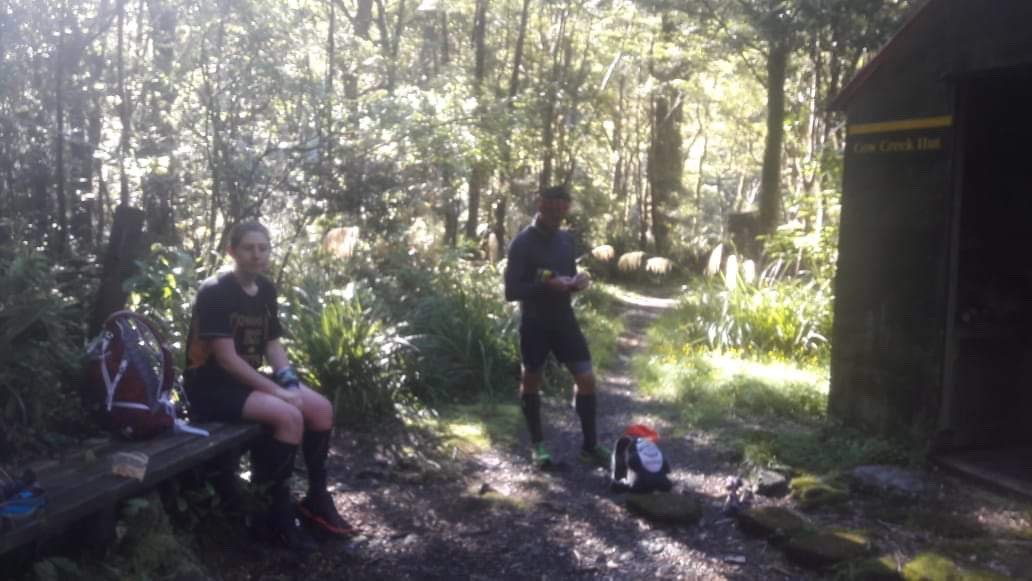
It was only after my daydreaming about how beautiful the river looked from up high, coming across some confusing signs that said Cow Creek hut was the way we had come from and Roaring Stag was from a totally different direction and some more running and daydreaming that had me go “Darryl, Emma, I think we are going the wrong way!”. We stopped checked the route, checked the maps, checked the GPS. Bugger we were definitely going the wrong way. Not to worry, back we went to Cleft Creek. Take two! Cleft Creek to Cow Saddle (and on to Cow Creek Hut)Now going the right way we confidently headed along the creek towards Cow saddle. I contemplated the error made. On the plus side it was an easy fix, on the downside it used up time and energy that I would have rather saved for later. But the real winner was the lesson it taught me, do not be complacent in the Tararua’s especially when it is dark later and you have been running all day! That lesson would be the most valuable lesson I learnt all day. Climbing up towards Cow saddle, first following the creek, then into the bush. I was excited to think that we would soon be hitting the track we did back a few months ago on our way up to Cattle ridge. I remember the sign of the cow, and sure enough there it was shimmering in the sunlight (665m) not far now down to the river over another amazing swing bridge and Cow Creek Hut. We took a moment to sit down, refuel and relax in the shade. It was not even 11am and the temperature was already ![]() . Cow Creek Hut to Mitre Flat HutAfter the last “detour” we took our time and made doubly sure we were running the right way this time. I knew it was along the Waingama river so the question was, upstream or downstream, left or right bank? Not taking any changes, we also checked on the GPS. We were good to go.The next section of the trail should be beautiful, it is beautiful, you are following a trail alongside the river. But man I found it hard work. The heat of the day, the early start and little sleep I managed were definitely catching up with me. Lots of tree fall to navigate, climbing and scrambling, lots of creeks to cross, cooling in the hot day, lots of traversing up and around slips, sometimes so close to the river it felt like you could jump in it, other times in the dense bush like the river was no where to be seen. At one point I asked myself the question “why on earth would anyone actually tramp here, it is really hard going” – we were averaging 3km/hr. At the time I could not think of an answer, but now it is obvious. The route is so remote we did not see a soul. The river so clear and blue you could see trout swimming around (the size of my fore arm). The mountains so big and tall all around you the green glowing against the blue sky. All the time the river shimmering and reflecting the light, drawing you into it to cool off from the heat of the day.
. Cow Creek Hut to Mitre Flat HutAfter the last “detour” we took our time and made doubly sure we were running the right way this time. I knew it was along the Waingama river so the question was, upstream or downstream, left or right bank? Not taking any changes, we also checked on the GPS. We were good to go.The next section of the trail should be beautiful, it is beautiful, you are following a trail alongside the river. But man I found it hard work. The heat of the day, the early start and little sleep I managed were definitely catching up with me. Lots of tree fall to navigate, climbing and scrambling, lots of creeks to cross, cooling in the hot day, lots of traversing up and around slips, sometimes so close to the river it felt like you could jump in it, other times in the dense bush like the river was no where to be seen. At one point I asked myself the question “why on earth would anyone actually tramp here, it is really hard going” – we were averaging 3km/hr. At the time I could not think of an answer, but now it is obvious. The route is so remote we did not see a soul. The river so clear and blue you could see trout swimming around (the size of my fore arm). The mountains so big and tall all around you the green glowing against the blue sky. All the time the river shimmering and reflecting the light, drawing you into it to cool off from the heat of the day.

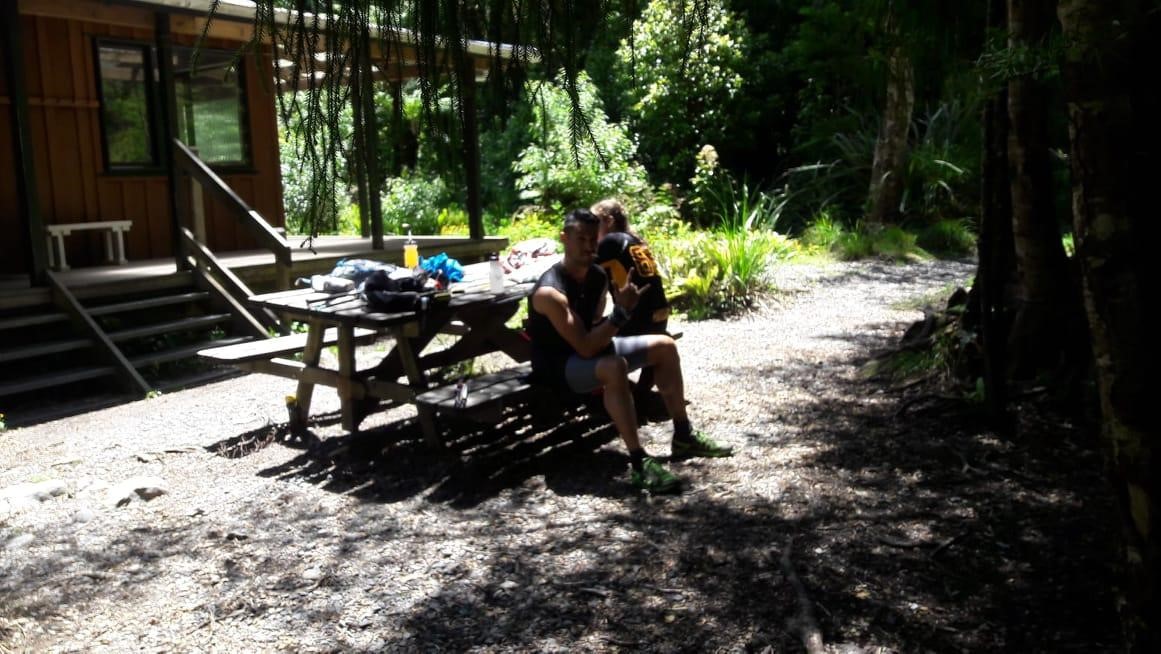
That’s why people come out here. A few times along that track we sat on a log, or by a stream feeding the river, trying to cool down, wondering how on earth we would get to Kaitoke. It really was a stunning day, but so very very very hot. But just before 2pm we arrive at Mitre Flats hut, just in time for some shade and a sit down, we were all cooking! Mitre Flats Hut to Atiwhakatua Hut According to the topo maps we had only done 22km, Garmin said more, even so we had over 50km to go. It seemed an impossible task. We had already done a bloody hard day out. Don’t think about it too hard Gwen, just one foot in front of the other! We knew when we left the hut we were straight into a climb up Barton track. The DOC signs said 4km to Atiwhakatua hut. We knew better and prepared for longer. It turns out that the climb was actually quite nice and the trail much easier than we had been running on. So we started to make better time. But alas, that did not last. This climb into the next valley had two parts to it, and whilst the first part was pleasant, the second part was more like what we had come to expect from this part of the Tararua’s. Towards the top of the climb Emma and I sat on some logs sweat stinging our eyes, dripping wet. Two happy but very hot and tired runners. Soon Darryl appeared not looking so good, “ladies, I can’t keep my heart rate down, the heat and the hills are too much today – I am calling it at Holdsworth”. We told him to see how he feels after the descent. We had come so far, he could not leave us now. After 2 hours of climbing, descending and climbing again we meet the fork in the trail towards the Atiwhakatua hut and as we expected the DOC signs were not to be trusted. It said we had done 3.5km from Mitre Flats Hut and still had 2.3km to get to Atiwhakatua Hut. Now I was hot and tired but even I knew that maths did not add up! We laughed and carried on our way, but soon with renewed energy knowing that we would be heading into well travelled tracks. Having not seen anyone all day this was an exciting milestone.Running into Atiwhakatua valley we crossed the river, Darryl ahead, I see him running on and assumed he just wanted to get a jump start on us, so I carried on running. But the further and faster I ran, the more I could not see Darryl. I thought “great, Darryl’s feeling better”. Then after a while stopped turned around to Emma and said “is Darryl behind us or in front”. She laughed, he was behind! He had gone to the river to cool down again. So we regrouped, Darryl was feeling worse. Atiwhakatua would be his last stop. Finally the hut appeared; and we joined a wonderful family with small kids for snacks and chats. It was great to tell the story of what we had done. I told them “thank god we did not reccie that part of the course first, or else we would have never embarked on the SK”. They laughed, we laughed. Emma told them that we were running to Kaitoke, “what tonight?”. “Yes – we have until 5.10am to get there!” They said they would think about us as they slept. But sadly the laughs needed to end and we had to say our tearful goodbye to Darryl. It was not your day today Darryl, but it will be soon, you are an absolute legend and a true inspiration. Keep being you! Atiwhakatua Hut to Pig FlatWhoop whoop, the running is awesome.

Fast and flowing we are on a motorway (well in relative terms). What difference a change of terrain and with it pace can do. The body felt great!!! How can this be? Mentally hitting the halfway mark in expected time (rather than distance) was uplifting. Garmin said we had done a marathon (the topo maps something less). Then crossing a bridge I banged my big toe hard. I yelped with pain, that really really really hurt. I had caught both my big toes several times throughout the day on tree roots. I think I might be saying goodbye to those toenails pretty soon ![]() The sign to our next climb, river ridge track all the way up to 780m at Pig flats. About 40mins and 4.6km of consistent climbing up “normal” size tree root steps.
The sign to our next climb, river ridge track all the way up to 780m at Pig flats. About 40mins and 4.6km of consistent climbing up “normal” size tree root steps.

It felt like a perfectly graded trail compared to the prior 12 hours of running ![]() . The day was still hot, even at 6pm and sweat was again stinging my eyes. But we knew that at the top we would have cell phone coverage and the excitement of sending a message home. From me “at Pig flats, wow that first section was very very hard”. From Emma “at Pig flats, tired but in good spirits”. I think that sums up the mood well. On to Totara! Pig flats to Totara Hut We turn off pig flats on to Totara Creek track. Downhill all the way to the Waiohine river. A quad and big toe crusher! And by the end a knee killer. The hop, skips and jumps that normally take me down a tree root descent were in short supply with me making ever increasing safe choices the more the body tired and the closer the river came. The closer you get to the bottom the more that steps start to replace tree roots, and a smile pops on my face. I did ask myself the question “why bother with the steps all the way out here”. There must be some good reason, all I could think of was that there was an easier way into the hut than the one we took. Apart from the well travelled trail of the Atiwhakatua river trail (and hut) we had seen no trampers on track or in the huts. So it was a welcome surprise to see a Dad and his son tramping down to Totara Flats, “you heading to the hut”. “No Kaitoke!” I chuckle as we run off down the hill. We do a final cross over the river straight into Totara hut and a sit down and our final fuel up before dark. Another long chat to a hut guest, only 3 people in the hut that night, he was down from Auckland to catch fish. We chatted and ate and renewed our energy (and shared our blood with the sandflies). But time to keep moving, it was 8pm and darkness was not far away. Totara Flats to Cone Hut (via Cone saddle)I was so happy to make it to Totara flats before darkness. Emma had never been here and I wanted her to see the flats in daylight. So stunning, the grass up to our waists with a single track flatted through it showing us the way. Some faster km’s as well all the way to where the flats meet the river. I remember doing this section with Darryl, Jade, Mel and Anna over winter and we followed the riverbed past the slip and around the bend. This time after the slip we took the trail through the forest. It was hard to tell whether it was faster or slower, by this stage I had no comprehension of time and Garmin decided enough was enough and at 51km and 2,400m elevation and 15hrs and 15mins it died.
. The day was still hot, even at 6pm and sweat was again stinging my eyes. But we knew that at the top we would have cell phone coverage and the excitement of sending a message home. From me “at Pig flats, wow that first section was very very hard”. From Emma “at Pig flats, tired but in good spirits”. I think that sums up the mood well. On to Totara! Pig flats to Totara Hut We turn off pig flats on to Totara Creek track. Downhill all the way to the Waiohine river. A quad and big toe crusher! And by the end a knee killer. The hop, skips and jumps that normally take me down a tree root descent were in short supply with me making ever increasing safe choices the more the body tired and the closer the river came. The closer you get to the bottom the more that steps start to replace tree roots, and a smile pops on my face. I did ask myself the question “why bother with the steps all the way out here”. There must be some good reason, all I could think of was that there was an easier way into the hut than the one we took. Apart from the well travelled trail of the Atiwhakatua river trail (and hut) we had seen no trampers on track or in the huts. So it was a welcome surprise to see a Dad and his son tramping down to Totara Flats, “you heading to the hut”. “No Kaitoke!” I chuckle as we run off down the hill. We do a final cross over the river straight into Totara hut and a sit down and our final fuel up before dark. Another long chat to a hut guest, only 3 people in the hut that night, he was down from Auckland to catch fish. We chatted and ate and renewed our energy (and shared our blood with the sandflies). But time to keep moving, it was 8pm and darkness was not far away. Totara Flats to Cone Hut (via Cone saddle)I was so happy to make it to Totara flats before darkness. Emma had never been here and I wanted her to see the flats in daylight. So stunning, the grass up to our waists with a single track flatted through it showing us the way. Some faster km’s as well all the way to where the flats meet the river. I remember doing this section with Darryl, Jade, Mel and Anna over winter and we followed the riverbed past the slip and around the bend. This time after the slip we took the trail through the forest. It was hard to tell whether it was faster or slower, by this stage I had no comprehension of time and Garmin decided enough was enough and at 51km and 2,400m elevation and 15hrs and 15mins it died.

Topo maps said we had done 41km. A big difference! A final sit on a rock by the side of the Waiohine river, watching the sun setting, contemplating climbing Cone saddle in the dark. The next goal was to find the start of the climb before darkness, and with head torches out as the trees made the trail gloomy we found it. Up we go! It was now pitch black, it goes dark fast! I was recognising tree fall as we climbed, this one has orange hazard tape and you go to the left, this one we went to the left last time and had to bush bash, let’s go right, we still had to bush bash. Finding the trail on the other side of tree fall was not always easy, so staying calm, focusing on clues in the trail and using GPS where needed kept us moving in the right direction, climbing, climbing, climbing. Somewhere near the top I said to Emma “we need to stop my knee is really sore, I will tape it some more and have some Panadol”. We calmly sat in the darkness, on top of a mountain in the Tararua’s, still in tshirts, still wiping sweat from our eyes. In a strange way very relaxing. Reflecting on the fact that we still had 7 hours of running still to go, I remember us both thinking “hard to believe it”. The climbing was slow in the dark, but we were doing it, staying on route, when we started to go down I knew we had crested the first of the peaks, we would go down before going back up again to make the final saddle push and the signs that would lead us to Cone Hut. Finally they came at 11.30pm, the sign says 1km and 20mins. I know you are misleading me sign; so we joked about it and set off descending to Cone hut.Cone hut to the bridge across the Tauherenikau riverYes! We are on the home straight. In normal run terms it’s still a long way, how long, I have long since stopped caring. But I know that it’s easier and faster following the Tauherenikau river. We did not stop at the hut, we have 5 hours to get to Kaitoke. For the first time I allow myself to think “we might just do this”. Time to get moving, and again I am amazed at how fast we are moving and how the change in terrain improves the energy levels. It feels great! With darkness the forest comes to life in a totally different way. The beautiful sounds of the Morepork, the possums, hundreds and hundreds of possums eyes glowing in our head torches, then watching us as we run by, their claws scratching around in the trees over our heads. The moths the size of my finger trying to dance in the beam of the light, the spiders and array of crawlers all darting out of our way as our feet pound down on the trail.
We were starting to gain a good rhythm with our running but then we would hit tree fall. Major tree fall, it looked very fresh. Slow to navigate around in the dark. But again, learning our lesson from this morning, don’t be complacent, back track to the orange markers, take our time, use the GPS. We always found our way around and back to the trail; the map and compass stayed safely tucked away in the dry bag. We travel through the changing terrain well until I find myself upside down in some bushes. How on earth did that happen. All I could do was lie there and laugh, I could not move, I could not get myself out, Emma had to pull me out! We are running along and now it’s Emma’s time to stop. A painful shin. Some pain meds; a rub, some pretzels and we are off again. As we ran I started to tick off some mental milestones, the grass flats, the block XVI turn off, the larger of the creek crossings, the small climb with the rope, the two arrows sending you down towards the bridge. It is here somewhere, we are so very close. And as we are turning around looking for clues we see it above our head, we are literally stood 2 meters from it. That brought some laughter out. 3.05am: The bridge to KaitokeRight Emma; let’s push. We were running well. This is insane, 22 hours on our feet and we are running well. Mixing up the running and power walking. Getting closer every step. Keep going straight Emma, just keep going straight. The mountain shelter, the Dobson track, the slip, the climb over more tree fall! But this time it was old tree fall and someone had cut a hole in the log to put your foot on. Very helpful, but Emma got stuck, legs stiff, nothing left in the body, I had to push her over and she tumbled down the other side. May be the bodies were not as fresh after all ![]() Then puffer saddle, the last climb and we can smell the finish. We are going to do it! We are over before we know it, hitting the Marchant ridge turn off and finally the 730m to go sign. Down the steps, the longest and most painful 730m of my life. Having to stop 2/3rds of the way down grateful that we were not up against the clock. Hands on knees, taking a moment. Then the forest signalling the ymca and the fence line and we hear “there they are; I can see their lights”. OMG! It was Darryl and Victoria, what absolute legends coming to see us over the finish line. It was such a celebration.
Then puffer saddle, the last climb and we can smell the finish. We are going to do it! We are over before we know it, hitting the Marchant ridge turn off and finally the 730m to go sign. Down the steps, the longest and most painful 730m of my life. Having to stop 2/3rds of the way down grateful that we were not up against the clock. Hands on knees, taking a moment. Then the forest signalling the ymca and the fence line and we hear “there they are; I can see their lights”. OMG! It was Darryl and Victoria, what absolute legends coming to see us over the finish line. It was such a celebration.

They really made it just the perfect finish. What an amazing; brutal, crazy, insane day! I loved it! Putara to Kaitoke via the valleys, 6 saddles and 5 rivers. 23 hours and 42 mins! Beers and chippies; chats and laughter in the car park as we saw the dawn break again and the start to another day! Wow! Did that just all really happen?